
Paddle Trails: Water Trails With No Tracks
When you hear the word “trail” connected with outdoor activities, do you automatically think of a pathway through the woods to be trod with hiking boots or pedaled on a mountain bike? If you do, you are, of course, correct, but you are also missing part of a much larger picture. Judging from the emails we receive, most of you feel passionate about your trails, whether they are for hiking, biking or even just strolling through urban cultural and historic setting. They are all trails.
Another trail option is especially attractive in the summer and fall. Across the northeast there are water routes that you can explore in a canoe or kayak for hours, days, or even weeks if you have the time. The beauty of most of these water trails is that they are accessible—at least in part—to anyone who wants to go exploring. Even if you’ve never been in a canoe or kayak you can borrow or rent a boat and play around for a couple of hours on the flatwater sections of rivers, on ponds or lakes or protected saltwater bays. Better yet, you can take a lesson. It’s fun, and as you get better you can explore longer and more challenging routes.
These water trails are beautiful places to explore, and there’s something magic about letting water carry most of the weight as you glide over the surface with almost-silent paddle strokes and listen to the sounds of flowing water, wind (hopefully not to much!) and, if you are lucky, the calls of loons and seabirds.
If you’re looking for paddle opportunities, I’d recommend getting the River Guidebooks published by the AMC and the paddlers guides to the Adirondacks published by the Adirondack Mountain Club. These list dozens, if not hundreds of day paddling options, plus campsites if you want to extend your explorations.
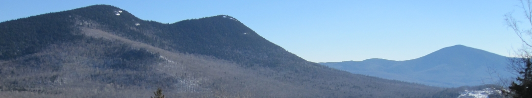
The Adirondacks, which is a land of ponds and rivers as much as water has some wonderful places to explore by paddle. So does Maine where famous routes like the Moose River Bow and the Allagash Waterway are just some of the possibilities to get out and explore a trail where you leave no tracks.
Paddle Trails: Northern Forest Canoe Trail
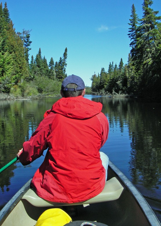
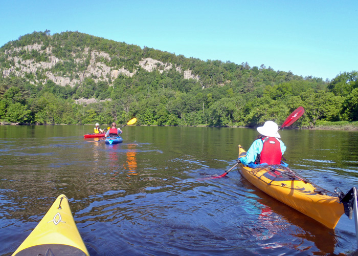
The 740-mile Northern Forest Canoe Trail, which was officially opened in 2006, stretches from Old Forge in the Adirondacks in New York to Fort Kent in Maine, passing through Vermont, Quebec and New Hampshire along the way. Thirteen published maps detail campsites, portage routes (62, totaling 55 miles), trail signs, and access points along the entire route.
While it is possible to paddle it end-to-end, and a number of people have done it, most people will paddle the NFCT in sections to avoid having to paddle upstream on some of the 22 rivers and streams along the route. I can’t even imagine, for example, trying to paddle, pole or even line a loaded boat upstream on Maine’s Rapid River.
The NFCT also includes 56 lakes and ponds, which are perfect places to get started if you aren’t a skilled river paddler. And much of the river paddling is easy flatwater with no rapids, You can do a significant portion of the NFCT without ever having to dodge a rock.
While almost any spot on the trail is perfect for a one-day adventure, the real purpose of the trail is to get people to explore longer. There are campsites all along the route at convenient intervals. Some of them are brand new, created since the NFCT was conceived. Others were used by Native Americans when they traveled this same route in birchbark and dugout canoes. When you paddle the NFCT, you are touching a significant piece of American history.
If you aren’t into camping, some sections of the route have beautiful inns and luxury B&Bs available.
Paddle Trails: The Maine Island Trail
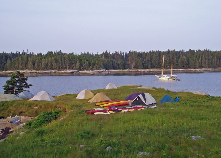
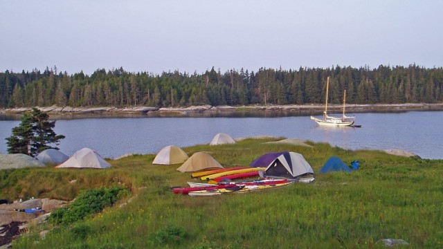
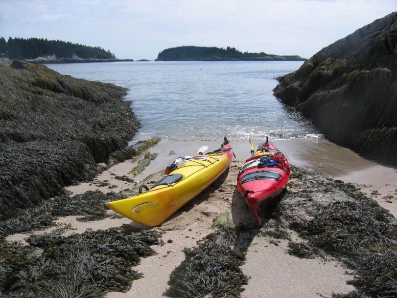
The Maine Island Trail is a 325-mile long winding salt water route extending from Casco Bay (near Portland) all the way to Machias Bay in far Downeast Maine. Accessible by motorboat, sailboat and, best of all, by sea kayak, The Maine Island Trail includes over 150 island and mainland sites which can be used for day visits or overnight camping.
The Maine Island Trail Association, maintains and monitors these public sites. They have a wonderfully detailed guidebook, published annually, which is available to members only and well worth the $45 annual membership fee. MITA sponsors many events, including island cleanups which are a great way to get introduced to the Trail.
Along the Maine Island Trail you can camp on uninhabited islands, stay in mainland campsites with flush toilets and showers, or paddle from luxury inn to luxury inn. It all depends on your budget and how adventuresome you are.
I first discovered the Maine Island Trail on a three-night, four day guided kayak tour with H2Outfitters on Penobscot Bay. We paddled among islands and past lighthouses, explored the shore of Isle au Haut, slept in tents on otherwise uninhabited islands, watched dolphins, jellyfish and seabird, ate like kings, swam in fresh water in an old quarry on an island. This was a magic adventure that I intend to repeat as soon as I can. H2O does all the planning, provides everything you need except the camping gear. You just show up and paddle.
A number of other guides can introduce you to the Maine Island Trail for a day or longer. The Maine Association of Sea Kayak Guides and Instructors has a full list of certified guides.
Paddle Trails: The Connecticut River Paddler’s Trail
Stretching over 400 miles from the Canadian border to Long Island Sound, the Connecticut River is an amazing resource for paddlers. The Connecticut River Paddler’s Trail is a series of launches and primitive campsites that will eventually span the entire river from the headwaters to the sea. It even intersects the Northern Forest Canoe Trail for awhile in northern New Hampshire.
They have published a wonderful map detailing the trail from the headwaters to the Massachusetts border, showing all campsites and access points.
Another resources the Online Boating Guide published by the Connecticut River Joint Commissions.