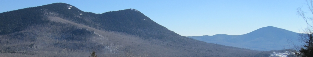


The next time you get near a map take a moment to savor it as the thing of beauty it is. Like a pirate’s treasure map, it shows the way to dreams, adventures and, possibly, hidden gems.
When you first start looking at a hiking map, your eye is captured by features like roads and trails that lead to natural features like mountain peaks, scenic overlooks, streams and hidden ponds. But most people, I’ll bet, never really look at the most prominent feature on almost any map—the empty spaces between the roads and trails, some filled only with elevation lines and, maybe, the icons for swamps or brooks. Those empty spaces are where the treasures are hidden.
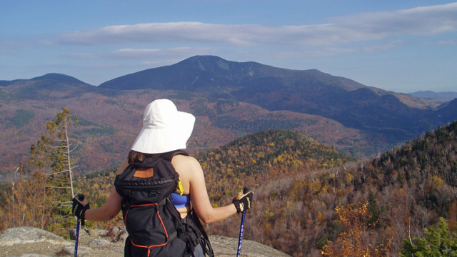
I know many very experience hikers who have never intentionally left a hiking trail for more than a momentary step into the woods to “answer the call.” Most of us, of course, have unintentionally gone wandering when we lost the trail. But how many of us deliberately step off the trail and go exploring? It’s usually called “bushwhacking,” and it’s fun.
I’m lucky. I started playing in trackless woods at a very young age. I can well remember the thrill of stepping into the woods behind our house, away from all sight of civilization. That’s the joy of bushwhacking
As a young teen I started hunting with my uncles and learned the fine art of going into the woods, using the sun or wind as my compass, and coming out where I wanted to, sometimes miles away. I also learned that, on cloudy, windless days, especially if there’s fog in the air, it pays to carry a compass. Now, when I go bushwhacking, I usually have three compasses along—so I can go with the two that agree if one goes haywire (it can happen.)
Everyone should learn bushwhacking skills the same way I did—a little at a time in a safe environment. In the chunk of land I first explored, you couldn’t go much more than a quarter mile in any direction without encountering a road.

Got a state park nearby? That’s usually a perfect place to start bushwhacking since most state parks are laced with roads and hiking trails, with “no man’s land” in between. And most state parks have free maps available. Find a piece of land that’s surrounded by roads or hiking trails, go looking to see what’s in there.
Head toward a baseline—a road, trail or stream that you can’t miss. By all means use navigation aids—a compass, a GPS, the sun. In most places, you won’t be able to just walk in a straight line. Anything from a downed tree to a thicket to a beaver swamp that isn’t on the map will get in the way. That’s good—it’ll force you to explore more unknown country.
Fall is a great time of year for bushwhacking. With the leaves down it’s easier to find your way. Two cautions apply, however. One, if it’s hunting season, everyone should be wearing safety colors. Two, falling leaves can obscure hiking trails, so if you’re using a trail as a baseline destination, be sure you don’t step right over it.
I can almost guarantee that, when you leave the roads and trails behind, you’ll eventually find yourself someplace that’s forever special to you. That’s the treasure you’re hunting.
Life isn’t a spectator sport. Get out and enjoy!
Bushwhacking Essentials

You need the same basic stuff to go bushwhacking safely that you need on a dayhike. Start with proper clothing and footwear. Walking offtrail is often rougher and wetter, so you might want boots rather than sneakers of shoes.
You also need a map. The bigger the chunk of land you are exploring, the better the map you need. The gold standard is the topographic maps published by the U.S Geological Survey (www.usgs.gov). But the maps you can print from today’s GPS mapping software are fabulous. Or, try one of the recreation maps published by various organizations such as the Appalachian Mountain Club or the Appalachian Trail Conservancy, the Green Mountain Club, the Adirondack Mountain Club and many others.
Be sure to take along your common sense when you go bushwhacking. And a human companion is essential, too, at least at first.