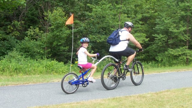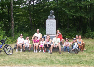
For the last several years my husband Doug and I have hosted what we call the “Family and Friends Flotilla.” It started as a way to get the entire family together and have some fun and for us to share the kind of activities we enjoy. (You can read about our Flotilla on the Baker River in 2009, and on the Bearcamp River in 2010 here.)
This kind of active family gathering is actually fairly easy to plan. It’s been a great experience for our family, and I highly recommend it for your family, too.
Biking Franconia Notch
2011 was the fourth annual, Flotilla and this year we added a Friday bike ride to our list of fun things to do during what’s evolved into a full week’s camping trip. Since we were camping near New Hampshire’s Franconia Notch, we thought we would give the Franconia Notch “bike trail” a try. We had heard good things about it from friends and, since it is mostly downhill, it sounded appropriate for our gang of cyclists that ranged in age from 10 to 66 with varied abilities and interests. Doug’s family is from Connecticut and hasn’t seen the wonders of Franconia Notch a bazillion times. Exploring by bike would entice the rest of us to take another, fresh look.
We talked to several people who assured us that the nine-mile ride was easy and mostly downhill, which was good news to our group, most of whom do not spend a lot of time on their bikes. Doug and I ride when we can on the Northern Rail Trail, which runs very near our home, but my bike is a fat-tire single-speed. If I can enjoy biking Franconia Notch on a bike with no gears, so can you!
We started at the trailhead for the Skookumchuck Trail, north of the Notch, which led to a few raised eyebrows and (good natured, we hope) comments about false advertising (remember that “mostly” downhill?). From this starting point, the first couple of miles have some uphill pedaling. Still, I didn’t have to walk my single-speed at all (and I don’t get out on my bike all that much). You can avoid the uphills almost entirely by starting at the parking lot at the Lafayette Bridge Overlook, Echo Lake, or at the foot of Cannon, where you can rent bikes for the trip.
If you do plan to rent, dress appropriately (meaning always wear a helmet and have, at least, sneakers on your feet) and bring water. Other options for renting bikes can be found at Loon Mountain or Rodgers Ski & Sport in Lincoln. Both offer transport to Echo Lake for rentals and personal bikes. Whether you are riding a rental or your own bike, make sure it is in working order and test your brakes, especially if you are going north to south. If you or someone in your group has physical limitations, contact New England Disabled Sports at Loon Mountain: They have hand cycles available and events throughout the summer.
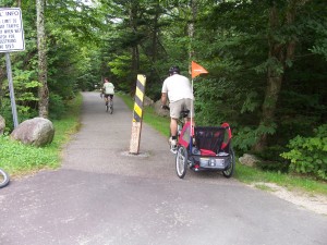
Motorized vehicles are kept off the trail at intersections with roadways by bollards. They narrow the space bikes have to pass, so be aware; you are going to see them again and again. They look intimidating at first, but proved wide enough for Doug to get through while towing our son Max in his Schwinn trailer.
Your first real view is of Mt. Lafayette as you cross a bridge that once was part of Rt 3. Ahead is a parking lot with a sculpture of former Governor Hugh Gallen. We had lunch there as some of our crew had apparently not eaten enough for breakfast (nudge, nudge).
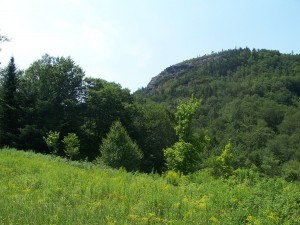
Use caution when getting back on the bike path. You are about to head downhill, and some of it proved steep, winding, and, for some in our crew, too wild for their blood. They walked their bikes.
Almost immediately the trail starts heading up again and comes out to an unusual (at least for those of us used to the view from the road) look at Artist’s Bluff. A bit more huffing and puffing brings you to Echo Lake and the end of any major uphills. A few of our crew took a quick dip in the lake, despite the wind and whitecaps (Franconia Notch State Park has a nice beach and charges $4 admission for adults; $2 for children ages 6-11; children ages 5 and under and NH residents age 65 and over are admitted free). It was a hot day and the water was reportedly “refreshing.” I think they meant cold.
By this point in the ride, we already had riders running low on water, so it was off to the Cannon Aerial Tramway Base, where we stopped for a long break and lunch for those not hungry earlier, ice cream (for a surprisingly good price!), and a water refill.
It’s a little unclear how to pick up the bike path from the Cannon Tram Base parking lot (the actual path bypasses it), so we sent out a search party to make sure the trail was where we thought it would be, and then a search party to find the search party. Eventually, we regrouped on the trail. The trick is to simply head south out of the parking lot.
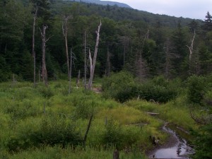
Soon you come to beautiful views of the cliffs on Cannon Mountain and Profile Lake. Despite the shouts of my crew to pedal like mad to make it up the hill, I stopped to take pictures. The hill was short but steep and, from a stand-still, I just barely made it on the single-speed without having to walk.
After one sharp left hand turn under the highway, you pedal to the edge of Profile Lake. From here the trail is almost all downhill (no kidding). You go back under the highway, past a great little access point to the tail end of Profile Lake (where we spotted a family of geese), and then come to a blissful respite from pedaling alongside the highway. Enjoy it, because once you get to Lafayette campground, the rest of the path parallels the notch highway for much of the way and traffic is steady on busy weekends.
Some great little pull-out spots along the trail reveal things you would never see otherwise: different views of landmarks you are used to seeing from the road; secret swampy areas where you might see a bear or moose. More than likely, unless you are on the trail when you are not supposed to be, (the trail is open ½ hour before sunrise to ½ hour after sunset), bears will be in hiding. We did, however, see several telltale, berry-laden bear pies on the path….
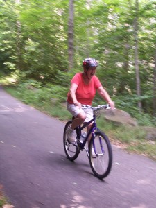
South of Profile Lake, keep your eyes peeled for “bike walk zones.” They aren’t always adequately marked. Keep in mind that this is, technically, a “multi-use” path and the walk zones are necessary for safety reasons. One of them stretches for a while and I can only guess that walking it really does make sense on a busy Saturday or Sunday.
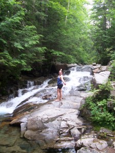
There are several places along the path near The Basin where you can stop and admire, and even take a dip in, the Pemigewasset River. There are enough pools and spots to pull off the trail so that, at times, we had the place to ourselves.
After the Basin parking lot, the bike path passes under I-93 again into a lovely woodsy section along the foot of Mount Liberty, and, beyond that, is the trailhead for Libery Springs Trail. There is a road crossing somewhere in this section that doesn’t appear on my map. It’s by no means a high traffic road, but keep an eye on the kids and the path.
Finally, you’re upon the Flume parking lot before you know it. If you’ve staged a car here, you can drive back to your starting point knowing you’ve experienced Franconia Notch in a new way; by Biking Franconia Notch you’ve seen the tourist spots and earned your ice cream, too!
If you go:
Franconia Notch State Park Recreation Path distances (Traveling South from Skookumchuck & Rt. US 3)
- Total mileage: 8.8 miles
- Skookumchuck to Lafayette Brook Bridge scenic vista south end: 1.49 miles (mostly uphill)
- Lafayette Brook Bridge to north end of Echo Lake and junction with Rt.18: 0.68 miles
- North end of Echo Lake to aerial tramway parking lot: 0.59 miles
- Tramway to north end of Profile Lake underpass: 0.54 miles
- North end of Profile Lake Underpass to southern end of Profile Lake hiker parking area: 0.68 miles
- Southern end of Profile Lake parking to Lafayette Campground: 1.3 miles
- Lafayette Campground to Basin viewing area: 1.7 miles
- Basin viewing area to Whitehouse Bridge: 0.88 miles
- Whitehouse Bridge to the Flume: 0.95 miles
Be Prepared:
While there are places, most notably at the Cannon tram building, where you can buy water, snacks, and even good ice cream along the trail, it’s always a good idea to carry water, at least, and your own snacks. This is especially important on a hot day, particularly, if you start at the north end.
Editors’ Trail Notes: More experienced cyclists who like to travel fast and far are not likely to enjoy biking Franconia Notch Recreation Path, especially on summer and fall weekends when it can get congested. But it can be a joy as a family ride if you pay attention to your own behavior and abilities and those of any children in your group. The more popular parts of the path around The Basin and other hotspots might require some walking of bikes to be safe. Bring a bike lock for side trips by foot to the notch’s attractions off the path.


