
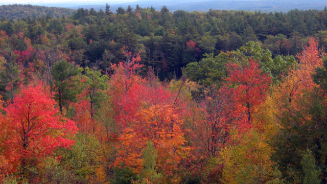
A walk in the woods, taken deliberately or by chance, is almost always an enjoyable experience; but when you take a walk at the right time of year (October’s a good choice), when the maples, red and white oak, beech, dogwood and poplar have transitioned to bright hues of red, yellow, orange, purple and gold, they stand in stark contrast to the surrounding hemlocks and pines. At this time of year, the seasonal change has worked its magic, and the astounding palette, carefully examined or not, can be stunning. Combine those colors with breathtaking views (which get even more expansive as the leaves fall), and you have a walk that will last in memory — perhaps, forever.
This guide is a sampler of what some would consider the best hikes in the Monadnock Region of New Hampshire for viewing fall foliage at its peak, or later; many people miss out on wonderful browns and yellows by thinking “oh, it’s too late, the foliage is past peak”, not to mention the better views created by fewer leaves on the trees. The list of hikes and walks is divided into two groups. The first are the hikes that require a certain level of fitness and agility to accomplish. The second is a grouping of easy rambles that just about anyone can enjoy.
If you are concerned that fall is hunting season, don’t be. Read our story on Hiking Safely In Hunting Season, then get out and enjoy!
Best Foliage Hikes in the Monadnock Region of New Hampshire
1) Cliff Trail on North Pack, Greenfield
The Cliff Trail from the summit of North Pack Monadnock offers a bird’s-eye view from a cliff on a saddle between Pack and North Pack. In the words of one area hiking diehard, “When the foliage is at its height, the colors are brilliant…. The combination of close-up and distance [views] makes for the best fall foliage viewing.” In the distance, of course, is Mount Monadnock to the west. When it’s clear, you can look south along the undulating topography of the Wapack Ridge all the way to Mount Watatic where it straddles the borders of New Ipswich and Ashburnham and Ashby, Mass. To get there, either start at Miller State Park off Route 101 or find the Wapack Trail trailhead on the south side of Mountain Road.
2) Thumbs Up on Skatutakee, Hancock

The Thumbs Up Trail connects the tops of Skatutakee and Thumb mountains in Hancock. To get there, you must take the Harriskat Trail across the street from the Harris Center for Conservation Education and head up Skatutakee or take a right turn at Thumbs Down Trail and eventually take a fairly steep climb up Thumb. The hike is about a mile and a half to Thumbs Up, which is about a 1.25- mile-long trail offering different views of the surrounding foliage as well as Hancock itself. You can also connect with Jack’s Pond and Old Dublin Road trails from the top of Skatutakee.
3) White Dot Trail on Mt. Monadnock, Jaffrey
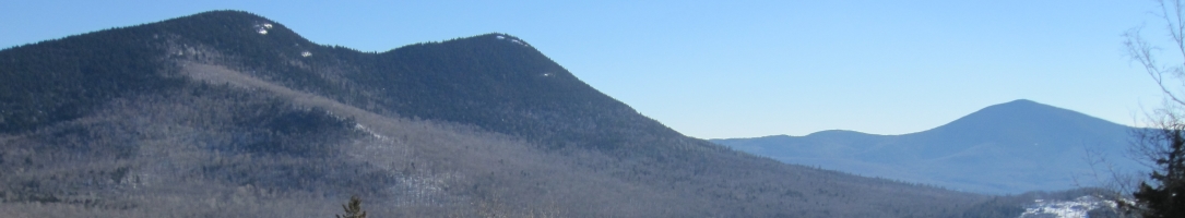
The White Dot Trail climbs 1.9 miles from Monadnock State Park headquarters off Route 124 to the summit of what is reportedly the second-most climbed mountain in the world next to Japan’s Mount Fuji. The White Dot Trail is the shortest and most direct route to the summit and takes hikers over rock slabs much of the time after starting on a dirt road. After the junction with the Cascade Link Trail, the trail ascends a stone staircase. At about the halfway point, you break out of the trees and the surrounding lowlands become visible. After diving back into woods for a bit, you emerge once again and are greeted with magnificent views to the south. There are many ledges from which to view the foliage, and of course the summit provides a full 360- degree aspect. To the northwest is Killington in Vermont; to the north is Mount Sunapee(the other terminus of the Monadnock-Sunapee Greenway) with Moosilauke, Lafayette and Mount Washington (which is easily visible when it’s covered with snow while others are bare) in the distance; to the east are the Pack Monadnocks; and to the southeast is Boston and Hancock Tower visible on crystal-clear autumn days.
4) The Shannon Trail on Crotched Mountain, Greenfield
Though the summit of Crotched Mountain has limited views, ledges along the way make the hike well worth it. Views to the south, southwest and west of Mount Monadnock as well as North and Pack Monadnock make this hike interesting any time of year, yet especially so during peak foliage season. The hike to the summit is a classic with families because it is among the easiest to hike, but the Shannon Trail toward the top adds some challenge. The trail is combined with the Summit Trail for much of the hike and becomes more of a test near the ledges, which provide the best views. Access can be gained from Crotched Mountain Rehabilitation Center off Route 31. Follow signs from Greenfield. At about a mile and a half from Route 31, a gated gravel road on the left marks the trailhead to both Shannon Trail and Summit Trail..
5) Wapack Trail, Temple
The Wapack is a 21-mile trail that stretches from Mount Watatic in Ashburnham, Mass. to North Pack in Greenfield, passing through sections of seven towns. The Wapack is one of the oldest interstate footpaths in the Northeast and essentially follows a ridgeline route along the summits of Watatic, Pratt, New Ipswich, Barrett and Temple mountains before dropping onto a shoulder and crossing Route 101 then ascending the Pack Monadnocks. The section of trail from Temple to Sharon affords open ledges and rocky peaks with impressive ridge views toward Mount Monadnock, the Berkshires and the Green Mountains to the west, Boston to the southeast, and the White Mountains to the north.
6) Bald Mountain and Willard Pond, Antrim
The hike up 2030-foot Bald Mountain is accessed from Willard Pond (a great place for a fall paddle, too), part of the dePierrefeu- Willard Pond Wildlife Sanctuary off of Route 123 in Hancock. The hike encircles Hatch Mill Pond before continuing along the shore of the 96-acre Willard Pond then ascending Bald Mountain, which provides scenic views from rocky ledges over the pond and to points south. From Hancock, take Route 123 north about three miles to Willard Pond Road. After about a mile and half, a parking area marks the trailhead.

Seven Easy Foliage Strolls
1) Pack Monadnock, Temple
Miller State Park wraps around the shoulders of Pack Monadnock and an automobile road to the summit affords views of Temple Mountain to the south and Mount Monadnock to the west for a day-use fee of $4 for adults ($2 for children 6 to 11; 5 and under and state residents age 65 and over are admitted free). If you are up for the climb, a fire tower, no longer used for detecting fires, affords a panoramic view of the surrounding countryside when the ranger is in. NH Audubon maintains a “Raptor Observatory” a short stroll form the summit parking lot with a naturalist on site during the fall hawk migration. Bring your birding binoculars! The park is located just off Route 101 near the top of the hill heading east out of Peterborough and is open Fridays, Saturdays and Sundays from 9 a.m. to 5 p.m.
2) Cathedral of the Pines, Rindge
Panoramic views of Mount Monadnock and its wide variety of deciduous and coniferous trees are just one of the features of this outdoor memorial to those who have given their lives in service to their country. There is a museum, gift shop and gardens. Located on Hale Hill Road just one mile from Route 119. Open through October 31.
3) Harris Center for Conservation Education, Hancock
You don’t have to climb any mountains to enjoy the foliage at this conservation center. In addition to the hiking trails and free weekend programs at the center, its naturalists often arrange guided walks and “ambles” of interesting public lands around the region. Find a calendar of events at the center’s Programs & Outings page at www.harriscenter.org. Located at 83 King’s Highway.

4) The Gregg Trail and Dutton Brook Trail at Crotched Mountain, Greenfield
These two recently opened trails are wheelchair accessible and begin just opposite the main entrance to Crotched Mountain Rehabilitation Center on Crotched Mountain Road. A switch-backing Gregg Trail takes you up to a platform with astounding views to the west, including Mount Monadnock, on a bluff where blueberries grow in late spring. The switchbacks offer great views to the east. At the end of the accessible section, the trail meets the more demanding Shannon Trail that continues across a blueberry reclamation project before diving into the woods for the push up Crotched Mountain. The Dutton Brook Trail is also accessible to wheelchairs and circles a pond just north of the rehabilitation campus. As you approach the rehabilitation center from Route 31, drive up Crotched Mountain Road. Immediately after passing Verney Road and the main entrance, look for access to parking on the left. The beginning of the accessible trails is immediately to the right as you turn in.
5) Wilton Center
The varied colors of beech, birch, oak and maple as well as a variety of ferns of gold and bronze hues line the fields and streets of Wilton Center, a quaint village with large houses, old barns, stone walls, and open views of the Monadnock region. It’s absent of commerce, so the relatively quiet roads are a pleasure to walk when the air turns crisp. You’ll find the center by following the signs for Andy’s Summer Playhouse when approaching on Route 101 from the west or the sign for the First Unitarian Church at a steep uphill right turn across from the Mobil station from the east. Andy’s is a children’s theater housed in a former Grange Hall with a parking lot.
6) Nussdorfer Nature Area, New Ipswich
Red and white oak, beech, poplar and hemlock trees provide the contrasting colors at Nussdorfer Nature Area. The area around Hoar Pond is also populated with a stand of tamarack, a deciduous coniferous species of larch that turns gold in autumn. The Hoar Pond Nature Trail starts with a short, steep climb before easing up and turning into an easier walk with some views to the north and east. The trail eventually winds around to nice views of a bog and pond. There is parking off Old Country Road, which is found from River Road off Route 124. Look for brown and white signs.
7) Edward MacDowell Lake, West Peterborough
Easy walk-to views of birch, poplar, maple, oak, beech, hemlock and alder can be found here. The varieties circle a large flood-control lake and a dirt trail ambles along its eastern shore. The Edward MacDowell Dam was built as a result of the Flood Control Act of 1936 and created a lake that has become a popular local spot for walking the family dog, fishing, and canoeing and kayaking. It affords a variety of scenic vistas as does a walk on top of the dam itself. Find the U.S. Army Corps of Engineers station at the end of Wilder Street off Union Street just west of Nature’s Green Grocer.
This is far from an exhaustive list; there are many more hikes possible in the region. If you have a favorite you’d like to share, add it to the comments list!