Do you consider yourself invincible in the outdoors? Do you deliberately seek out challenges that other people would find impossible? Do you enjoy pushing yourself beyond the limits of endurance? If that’s you, you can stop reading right here. This story is about setting a goal that almost anyone in reasonable physical shape can achieve in increments with some careful planning and dedicated effort. There are hundreds of similar challenges to be found in the outdoors. What works as a challenge for you will depend on your fitness level and what you enjoy doing.
Here at EasternSlopes.com, none of us are heroes. We are just people like you who enjoy getting outdoors and finding fun alone or with our friends and families. That’s why we share our stories, hoping to inspire you to do more in the outdoors. But we also do believe it’s important to safely and sensibly push personal limits, to set goals and challenge yourself incrementally. Our female correspondents are particularly prone to this: Marti Mayne, for example, conquered her acrophobia by first trying zip lining, then rock climbing with her family. Later, she found herself harnessed to a parasail while wearing skis in Quebec. Susan Marean Shedd, did a two-night solo backpacking adventure on the side of a mountain. Deborah Lee Luskin took a whitewater kayaking course. Marilyn Donnelly, a hesitant swimmer, has sea kayaked with the wind and waves (and whales!) on Casco Bay in Maine and Saguenay Fjord in Quebec. But, they’re not the only ones to try new challenges. Warner and Edie Shedd, who had never before ridden on a ski lift, tried snowbiking at Pats Peak at ages 75 and 78. Brett Lund headed out to ski the Chic-Choc Mountains on Québec’s Gaspé Peninsula. Then of course, there’s Max, our youngest staffer, who gamely tried snowshoeing at age 2 1/2 and was testing kids’ snowshoes at 3 1/2. Max also went hiking to and overnighting in an AMC hut and whitewater rafting when he was 3, and cross-country skiing when he was 4. If any of one us is a hero, it’s Max.
My Goal, What’s Yours?
Personally, I’m notably risk-averse in the outdoors. Call me cautious, but I always learn new skills or tackle new challenges in small, safe increments, and am always on the lookout for trouble before it develops. My goal is always to get outdoors, have fun, and get home in one piece and in better shape to get out again and have more fun. Getting badly hurt or even killed is not a part of the plan, so I tend to shy away from extremes. But for a long time, I’ve nursed a particular dream that some people might says sounds a bit on the extreme side. I want to stand on top of the highest points in Maine, New Hampshire, Vermont, Massachusetts and New York. All under my own power (three of the high points have roads to near the summit, one also has a gondola). Sounds like a simple, worthy goal, right? But my personal goal is to stand on all these high points in winter, my favorite season. That’s just my own preference; it’s just as good a goal for other seasons. Climbing to all in a single season is probably going to have to wait until my work schedule is less demanding, but I know I can check at least one or two off each winter. And who knows? Maybe I can pull them all off this winter; we’ll have to wait and see.
I’ve put off this goal for too many years, claiming that I’ve been too busy with work or family, or not in good enough shape, or simply doing other things I enjoy more. (Do any of these excuses sound familiar to you?) Excuses are just that, excuses. I’ve already made a good start and will be sharing those stories with you. But if this sounds like it might be something you’d like to try yourself, here are some of the basics to help you get started:
Defining The Challenge: Summiting The High Points
The five high points are Mount Washington (6,288 feet) in New Hampshire, Mount Marcy (5,344 feet) in New York, Mount Katahdin (5,268 feet) in Maine, Mount Mansfield (4,395 feet) in Vermont, and Mount Greylock (3,488 feet) in Massachusetts.
Greylock is smallest and the easiest–but that doesn’t mean it’s going to be easy for everyone. Most routes up the mountain gain about 2300 feet of altitude, so come prepared for a pretty good workout (relatively comparable to climbing Mount Monadnock in southwestern New Hampshire). That makes it a good warmup—just pick a good day and go. You can park right at the base of the mountain and there are a number of routes to choose among. Sure, it can be made more challenging—just pick a longer and more difficult route or go when the weather’s not so nice. But that’s not the point . . . not the first time, at least. My only prior ascent of Greylock had been while doing a section hike on the Appalachian Trail. That had been in September, in hurricane force winds, thick fog and driving rain—I didn’t linger to enjoy the view.
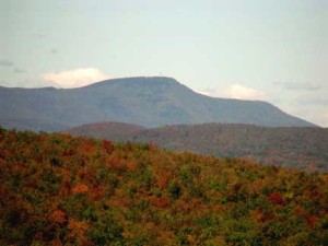
Mansfield is also easily accessible and has a number of possible routes to the top. With Stowe Mountain Resort right there, this is a very civilized mountain. It’s merely a matter of picking a nice, clear day and climbing any of the trails from Route 108 or Underhill State Park, then on up to the Chin, which is the actual summit. There’s nothing inherently difficult or dangerous about the climb other than the usual challenges of altitude gained and lost. I’ve been on top of Mansfield several times on perfect powder mornings, but had always cheated and taken Gondola at Stowe Mountain Resort most of the way up and then boot-packed up “The Chin,” the actual summit of the mountain. I’ve never summited Mansfield under my own steam.
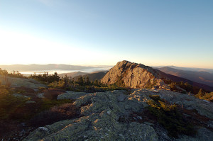
Marcy, too, is a fairly straightforward proposition. The shortest and most popular trail starts at the Adirondack Loj near Lake Placid. Though it’s 7.4 miles to the summit from the parking lot, and climbs 3,166 feet, it’s not technically difficult. Again, it’s just a matter of picking the right day and doing it—or, if 15 miles in one day is too much, picking the the right two days and camping along the trail at Marcy Dam two miles from your car. I’d never climbed Marcy before I decided on the Aiming High challenge.
Katahdin and Washington are a different matter entirely. People die pretty regularly on both of these BIG mountains, though Washington is, historically, by far the deadlier of the two (probably because it’s a lot more accessible and many, many more people climb it). Usually, the casualties are people who aren’t physically prepared to handle the challenge (think “heart attack”), who don’t have the right equipment and skill set (think, “lost,” “hypothermia,” or “slip and fall”), or people who simply underestimate the dangers present (avalanche, ice fall, crevasses). Washington has been called “the most dangerous small mountain in the world.” No less a figure in international mountaineering than Paul Petzolt, the founder of the National Outdoor Leadership School (NOLS), referred to Washington as “the great booby trap of the East.”
Both Washington and Katahdin are very doable if you are in reasonable shape and appropriately careful. But they still represent a challenge that’s out of the comfort zone for most of us. I’ve climbed Mount Washington a number of times, but have only gone to the summit in “winter” once, on an absolutely perfect bluebird day in April as a side-trip while skiing Tuckerman Ravine. I’ve only climbed Katahdin once, but it was decades ago in beautiful early-fall weather. If you aren’t familiar with trekking on steep snow, and want to do them in winter, the safest alternative for both of these BIG, dangerous mountains is to sign up for a guided trek (see below).
Summiting The High Points: Timing and Planning
It’s a very human trait to think that our calendar actually matters. I’m as guilty as anyone, since I want to climb these mountains in “winter.” It all comes down to how you define the season. Meteorologists say winter is December, January and February. Most people define the year by the sun: summer is from the summer solstice to the autumnal equinox, etc. But mountains, especially the three tallest on our Aiming High list, don’t seem to pay any attention at all to our notions of seasons. Summer is the rarest of seasons and Winter can visit the summit on any given day of the year.
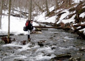
Oddly, while Winter would seem like the ultimate in difficulty and danger, Spring is probably the most dangerous time to tackle any of the highest points in the northeast. In the right weather and snow conditions, Winter travel can actually be easier than summer as trail surfaces can be smooth and uniform and very easy to walk on with proper traction aids. By contrast, mud, lingering ice, and brooks raised to torrents by snowmelt can make an otherwise straightforward Spring hike suddenly very dangerous. But Winter also brings with it the added challenges of deep cold and short days,
Summer also presents its challenges–sweltering heat at the trailhead can often give way to winter-like weather on the summits. Remember, in more than 70 years of record keeping, the HIGHEST temperature ever recorded on the summit of Mount Washington is 72°F. The average temperature in July is 48°F., and they record temperatures below freezing an average of 242 days per year.
Summiting The High Points: Incremental Challenges

If you choose to take on the “Aiming High” challenge, you are obviously going to do them in whatever order makes sense for you. But, if you aren’t already experienced at summiting mountains, I wouldn’t recommend starting with Washington or Katahdin. Even Marcy might be a stretch. Getting to the top isn’t that hard if you are in reasonable shape, but getting up and back down often is.
For a number of reasons, I’d recommend starting with Greylock. It’s the smallest, obviously, but it’s still a worthy hike and the views from the top are worth the effort in any season. Most of the trails on Greylock gain around 2,200 to 2,300 feet from trailhead to summit. If you can climb up Greylock easily in a half day, and get back to your car without blisters or excessive knee pain, you are probably ready to tackle Mansfield. One note on Greylock: on most trails, especially on the steep eastern side, you are in the woods and relatively protected from wind until just short of the summit. It’s possible to climb Greylock comfortably on days when the other mountains would be inaccessible. A good source for descriptions of the trails on Greylock is the Massachusetts Trail Guide published by the AMC. It includes a very detailed map of Greylock and the surrounding mountains.
On Mansfield, you have also have a number of choices of routes. Some of them are longer and relatively gentle. Sunset Ridge from Underhill State park climbs 2,600 feet in 3.3 miles. Others are shorter but quite steep: the Long Trail Southbound from Route 108 climbs 2,800 feet in 2.3 miles. The longer, less-steep routes are probably better overall preparation for Mount Marcy, which is largely an endurance contest. But if you can do a steep route in reasonable time, you are probably ready for Marcy, too. The steeper trails on Mansfield tend to keep you in the woods until nearer the summit. The longer trails along the ridge line (like Sunset Ridge) are particularly exposed to wind and weather. That may affect which you choose. For good maps and trail descriptions of the hiking options on Mansfield, check out the Long Trail Guide from the Green Mountain Club. Or, if you want just a map you can carry in your pack (always a smart idea), they have a waterproof Map of Mount Mansfield and the Worcester Range.
Though there are a couple of fairly steep sections on the most popular trail up Mount Marcy (the Van Hoevenburg, which begins at the Adirondack Loj near Lake Placid), they are also relatively short—especially when compared to the overall length of the journey. Realistically, 15 miles of hiking is a test for most of us–not only for lungs, knees, and leg strength but also for the fit of our boots and, to some degree, simple mental toughness. Prepare for a long, hard day if you want to summit Mount Marcy, and that’s if the weather cooperates. The last mile or so of the trail up Marcy is in the Alpine Zone, very exposed to wind and weather. Carrying the right safety gear and assessing weather conditions and your own state of being before you tackle that last mile are important skills which will serve you well on Katahdin and Washington. If you don’t have the gear to keep you safe, or if the weather is showing signs of deteriorating, or if you aren’t sure you have it in you to finish the climb and get back safely, TURN AROUND! For a trail description and map, get the High Peaks Trail Guide and Maps Package from the Adirondack Mountain Club.

Summiting The High Points: The Biggest Challenges
Once you’ve checked the three smaller highest peaks off your “Aim High” challenge, you probably know enough about yourself in the mountains to tackle the two big hills left on your list. The question is, which to do first? Here’s the dilemma: Mount Washington is the highest of the peaks and the natural inclination would be to save it for last. But Katahdin is far less accessible for most of us and, objectively a longer, tougher climb. Frankly, it’s a toss-up. Summiting Washington first may be just the incentive you need to get yourself to and up Katahdin.
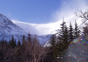
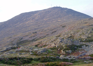
Climbing Mount Washington means gaining roughly 4,000 feet of altitude from the trailhead and all routes are exposed in extreme weather. Mount Washington boasts of having some of the worst weather in the world; the summit observatory records hurricane force wind an average of 110 days each year. It’s hard to get an exact count of the number of people who have died while hiking, climbing and skiing on Mount Washington, but the number is approaching 150 since the first recorded death in 1849. Probably the easiest route up Washington, is the Mount Washington Auto Road (7.6 miles from the base, 4, 618 feet elevation gain to the summit), but sharing your path with motor vehicle traffic would likely be unpleasant and dangerous. The Crawford Path from Crawford Notch is comparable ( 8.5 miles from the parking lot and 4,900 vertical feet to the summit). Most of the elevation gain happens pretty gradually. That’s more than 2 miles longer than the trek up Marcy with an additional 1,900 feet of vertical. When the AMC’s Mispah Springs and Lakes of the Clouds huts are open in summer and fall, it’s easy to break this into a two-day trek with a very comfortable overnight, and you can still carry a relatively light pack.
The most direct route to Mount Washington’s summit with the least elevation gain is the steep Ammonoosuc Ravine Trail (4.6 miles, 3,800 feet) which starts at the Cog Railway base. But the most popular summer and fall route is the Tuckerman Ravine Trail (4.2 miles, 4,250 feet elevation gain). In winter, most people choose the safest route up the mountain which is the Lion Head Winter Route (4.3 miles, 4,250 feet), open whenever danger of falling ice or avalanche closes the Tuckerman Ravine trail through the Ravine and the summer Lion Head trail.
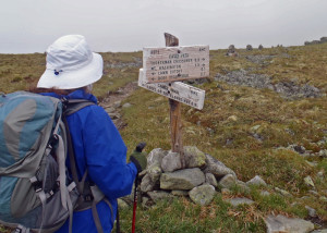
Whatever route you are contemplating on Mount Washington, you’ll find detailed and accurate route information and maps in the AMC White Mountain Guide.
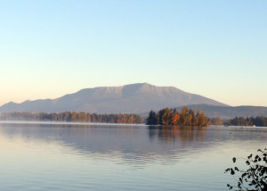
Katahdin, too has any number of trails to Baxter Peak. The most direct route to the summit is the Abol Trail (4.2 miles total with 1 mile on the Hunt Trail to the summit, with 3,986 feet of elevation gain), The Hunt Trail (part of the Appalachian Trail) is 5.5 miles and 4,169 feet. Probably the gentlest route is the Saddle Trail from Chimney Pond campsite. From the trailhead at Roaring Brook Campground, it’s a 3.3 mile hike (gaining 1,425 feet) to Chimney Pond; from there it’s 2.2 miles, gaining 2,353 feet to Baxter Peak. Another route from the Chimney Pond campsite, the Cathedral Trail, is 1.7 miles to Baxter Peak with the same elevation gain. There are several great sources for trail descriptions and maps for Katahdin. You can find much of what you need for planning on line at the Baxter State Park website. The AMC’s Maine Mountain Guide has excellent trail descriptions and maps.
Weather Reports
One of the benefits of current information technology is that you can get updated weather information before you climb.
For Mount Greylock: http://www.mountain-forecast.com/peaks/Mount-Greylock/forecasts/1064
For the Adirondacks and Green Mountains (including Marcy and Mansfield): http://www.erh.noaa.gov/btv/mountain/
For the White Mountains including Mount Washington: http://www.mountwashington.org/weather/
For Mount Katahdin: http://www.mountain-forecast.com/peaks/Mount-Katahdin/forecasts/1606
Going Guided
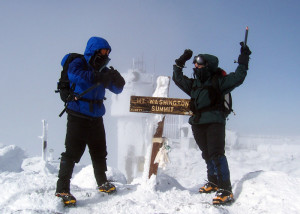
Greylock and Mansfield are “civilized” mountains with resources nearby to help you if you get yourself into trouble. Marcy, Washington and Katahdin are different. Even with a summit observatory manned year round and a very experienced cadre of search and rescue teams always on call nearby, people have died of exposure on Washington’s summit only a few feet from safety. If you have any concerns about your ability to get yourself up and down these mountains on your own, consider making your trip with any of the top-notch guide services that work on these mountains. These professionals will supply you with the equipment and the leadership you need to get you up and back safely. In the case of Marcy, Washington and Katahdin, having a guide just makes sense, especially in winter and early spring when conditions can change in a heartbeat and avalanches are possible on many of the routes. And as a bonus, you’re pretty much guaranteed to learn tricks and techniques just from spending the day with a professional.
On Mount Marcy, the EMS Lake Placid Climbing School, the Adirondack Mountain Club, and High Peaks Mountain Guides all offer guiding services.
Mount Washington has many options for guided trips. The EMS Climbing School, IMCS, Joe Lentini’s Ascent Services, Synnott Mountain Guides, Mooney Mountain Guides, and Adventure Spirit Guides run combinations of mountaineering classes and one-day summit climbs. They also offer climbs combined with overnights at the Mount Washington Observatory, and multi-day Presidential Range traverses (which sound like even more fun).
On Katahdin, Acadia Mountain Guides is the premier guiding service . I’ve rock climbed with them on the sea cliffs of Acadia National Park in the summer and have taken a Wilderness First Aid course with owner Jon Tierney. I can recommend this outfit without reservation.
My advice: if you think you might want a guided ascent, contact them all, check what they offer and go with the one you feel most confident with.
Added Challenges
If simply climbing one peak in a day in the season of your choosing isn’t enough of a challenge for you, all of the highest points have other peaks nearby which can be tackled in the same trek.
Greylock is really the highest point in a large saddle that includes several notable summits that are the highest mountains in Massachusetts. These summits include Saddle Ball Mountain (3,247), Mount Fitch (3,110), Mount Williams (2,951), and Mount Prospect (2,690), all of which can be be summited by following the Appalachian Trail.
Mansfield, too, has several summits, including the Forehead, the Nose and the Chin (the highest summit), all crossed by the Long Trail.
If you take the Van Hoevenburg Trail up Marcy, you have to pass the Phelps Trail which leads 1.2 miles to the summit of Phelps Mountain (4,160)
Mount Washington has Mount Monroe (5,372) a little over a mile from the main summit, plus Mounts Gray (5,533), Jefferson (5,716), Adams (5,799) and Madison (5,366), all accessible from the Appalachian Trail. There are also two prominences (which don’t count as separate peaks), Ball Crag (6,112) and Nelson Crag (5,635) both crossed by the Nelson Crag Trail.
Katahdin also has several attached peaks, including South Peak (5,218), and Pamola (4,919) which are joined by a trail called the Knife Edge (NOT a good idea in the winter, however; it’s very exposed). Nearby are Hamlin Peak (4,756) and Howe Peak (4,750)
What About Canada?
Mount Caubvick/Mont D’Iberville (5,420/5,410–it’s the same summit, the Provincial border line apparently missed the actual peak) is the highest point in Labrador and Quebec. But it’s in the Torngat Mountains National Park roughly 100 miles east of Kangiqsualujjuaq, Quebec. That makes it a major wilderness expedition requiring chartered aircraft or a long snowmobile ride and more time, money and technical climbing skills than most of us have available. It’s supposedly a challenging, technical climb, and at least two people have died attempting it. It’s probably not do-able for ordinary people, not in winter, anyway. The winter climate that far north is severe enough at sea level, and just gets worse as you go up.
So…what to do? If you want to top out in Quebec, your best bet is probably Mont Jacques-Cartier at 4,160 feet on the Gaspé Peninsula. I’ll call that good enough for my purposes!
In New Brunswick, the high point is Mount Carleton (2690). They say from the top you can see 10 million trees . . . definitely on my bucket list.
Though White Hill, the high point in Nova Scotia is only 1,747 feet, it takes a 27-mile round trip hike to get there. It’s in the highlands of Cape Breton Island, which is always worth a visit.
The highest point in Newfoundland is The Cabox (2,671) in the Lewis Hills southwest of Corner Brook. This range of hills and its neighbors get a tremendous amount of ocean-effect snow each winter and the backcountry skiing in this area is fabulous, but avalanches are common. Definitely do your homework if you’re going to try this one!
Are You “Aiming High”?
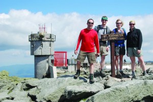
Ultimately, any of the climbs in this article can be a challenge depending on your personal fitness and/or the weather. Regardless of whether you want to try them in fall, winter, or summer (yes, you can try spring, but we really don’t recommend it), make sure you’re prepared for all the fun things that can go wrong; changing weather, breaking equipment, falls, sprains, strains, you name it. Do them with a friend; it’s more fun, and a whole lot safer. Remember, the name of this game is to have FUN, and to be able to get back out again and do more. Spending a cold, miserable night by the side of the trail because you went out alone without a sleeping bag and sprained your ankle isn’t likely to make you want to try it again. Since I’m so risk averse, I’m going to OVERprepare. I’d rather carry a few extra pounds than worry that I don’t have enough food, water, or warmth for an overnight. Winter’s here; out I go, and I’ll let you know how it goes!


